 KDE API Reference
marble
#include <GeoGraphicsItem.h>
Public Types | |
| enum | GeoGraphicsItemFlag { NoOptions = 0x0, ItemIsMovable = 0x1, ItemIsSelectable = 0x2, ItemIsVisible = 0x4 } |
Public Member Functions | |
| GeoGraphicsItem (const GeoDataFeature *feature) | |
| virtual | ~GeoGraphicsItem () |
| const GeoDataFeature * | feature () const |
| GeoGraphicsItemFlags | flags () const |
| virtual const GeoDataLatLonAltBox & | latLonAltBox () const |
| int | minZoomLevel () const |
| virtual void | paint (GeoPainter *painter, const ViewportParams *viewport)=0 |
| void | setFlag (GeoGraphicsItemFlag flag, bool enabled=true) |
| void | setFlags (GeoGraphicsItemFlags flags) |
| void | setLatLonAltBox (const GeoDataLatLonAltBox &latLonAltBox) |
| void | setMinZoomLevel (int zoomLevel) |
| void | setStyle (const GeoDataStyle *style) |
| void | setVisible (bool visible) |
| void | setZValue (qreal z) |
| const GeoDataStyle * | style () const |
| bool | visible () const |
| qreal | zValue () const |
Protected Attributes | |
| GeoGraphicsItemPrivate *const | d |
Detailed Description
Definition at line 30 of file GeoGraphicsItem.h.
Member Enumeration Documentation
| Enumerator | |
|---|---|
| NoOptions | |
| ItemIsMovable | |
| ItemIsSelectable | |
| ItemIsVisible | |
Definition at line 36 of file GeoGraphicsItem.h.
Constructor & Destructor Documentation
|
explicit |
Definition at line 22 of file GeoGraphicsItem.cpp.
|
virtual |
Definition at line 28 of file GeoGraphicsItem.cpp.
Member Function Documentation
| const GeoDataFeature * GeoGraphicsItem::feature | ( | ) | const |
Returns the placemark for that item.
Definition at line 62 of file GeoGraphicsItem.cpp.
| GeoGraphicsItem::GeoGraphicsItemFlags GeoGraphicsItem::flags | ( | ) | const |
Get the GeoGraphicItemFlags value that describes which flags are set on this item.
- See also
- QFlags
Definition at line 43 of file GeoGraphicsItem.cpp.
|
virtual |
Returns the bounding box covered by the item.
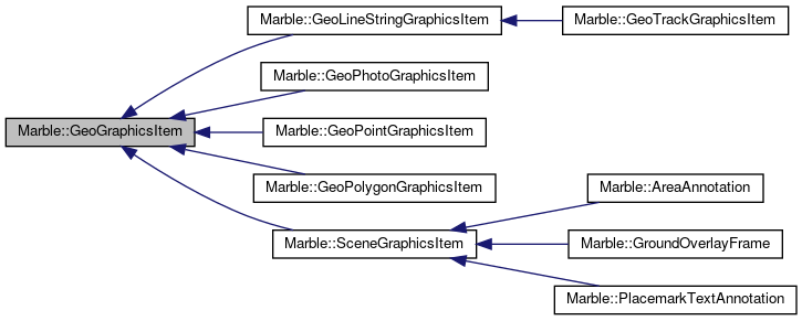
Reimplemented in Marble::GeoPhotoGraphicsItem, Marble::GeoPointGraphicsItem, Marble::GeoLineStringGraphicsItem, and Marble::GeoPolygonGraphicsItem.
Definition at line 67 of file GeoGraphicsItem.cpp.
| int GeoGraphicsItem::minZoomLevel | ( | ) | const |
Returns the minim zoom level on which item will be active.
Definition at line 107 of file GeoGraphicsItem.cpp.
|
pure virtual |
Paints the item using the given GeoPainter.
Note that depending on the projection and zoom level, the item may be visible more than once, which is taken care of by GeoPainter.
Implemented in Marble::GeoPhotoGraphicsItem, Marble::AreaAnnotation, Marble::GeoLineStringGraphicsItem, Marble::GeoPolygonGraphicsItem, Marble::GeoPointGraphicsItem, Marble::GeoTrackGraphicsItem, and Marble::PlacemarkTextAnnotation.
| void GeoGraphicsItem::setFlag | ( | GeoGraphicsItemFlag | flag, |
| bool | enabled = true |
||
| ) |
Set or unset a single flag.
- Parameters
-
enabled sets if the flag is to be set or unset
Definition at line 48 of file GeoGraphicsItem.cpp.
| void GeoGraphicsItem::setFlags | ( | GeoGraphicsItemFlags | flags | ) |
Replace all of the current flags.
- Parameters
-
flags is the new value for this item's flags.
Definition at line 57 of file GeoGraphicsItem.cpp.
| void GeoGraphicsItem::setLatLonAltBox | ( | const GeoDataLatLonAltBox & | latLonAltBox | ) |
Set the box used to determine if an item is active or inactive.
If an empty box is passed the item will be shown in every case.
Definition at line 72 of file GeoGraphicsItem.cpp.
| void GeoGraphicsItem::setMinZoomLevel | ( | int | zoomLevel | ) |
Sets the minimum zoom level.
Definition at line 112 of file GeoGraphicsItem.cpp.
| void GeoGraphicsItem::setStyle | ( | const GeoDataStyle * | style | ) |
Set the style for the item.
Definition at line 77 of file GeoGraphicsItem.cpp.
| void GeoGraphicsItem::setVisible | ( | bool | visible | ) |
Definition at line 38 of file GeoGraphicsItem.cpp.
| void GeoGraphicsItem::setZValue | ( | qreal | z | ) |
Set the z value of the item.
Definition at line 92 of file GeoGraphicsItem.cpp.
| const GeoDataStyle * GeoGraphicsItem::style | ( | ) | const |
Returns the style of item.
Definition at line 82 of file GeoGraphicsItem.cpp.
| bool GeoGraphicsItem::visible | ( | ) | const |
Definition at line 33 of file GeoGraphicsItem.cpp.
| qreal GeoGraphicsItem::zValue | ( | ) | const |
Returns the z value of the item.
Definition at line 87 of file GeoGraphicsItem.cpp.
Member Data Documentation
|
protected |
Definition at line 122 of file GeoGraphicsItem.h.
The documentation for this class was generated from the following files:
Documentation copyright © 1996-2020 The KDE developers.
Generated on Mon Jun 22 2020 13:13:45 by doxygen 1.8.7 written by Dimitri van Heesch, © 1997-2006
KDE's Doxygen guidelines are available online.