 KDE API Reference
marble
Marble::GeoDataInnerBoundary Class Reference
#include <GeoDataPolygon.h>
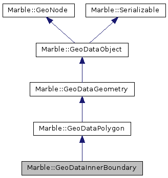
Inheritance diagram for Marble::GeoDataInnerBoundary:
Additional Inherited Members | |
 Public Member Functions inherited from Marble::GeoDataPolygon Public Member Functions inherited from Marble::GeoDataPolygon | |
| GeoDataPolygon (TessellationFlags f=Tessellate) | |
| GeoDataPolygon (const GeoDataGeometry &other) | |
| virtual | ~GeoDataPolygon () |
| void | appendInnerBoundary (const GeoDataLinearRing &boundary) |
| virtual bool | contains (const GeoDataCoordinates &coordinates) const |
| QVector< GeoDataLinearRing > & | innerBoundaries () |
| const QVector < GeoDataLinearRing > & | innerBoundaries () const |
| virtual bool | isClosed () const |
| virtual const GeoDataLatLonAltBox & | latLonAltBox () const |
| GeoDataLinearRing & | outerBoundary () |
| const GeoDataLinearRing & | outerBoundary () const |
| virtual void | pack (QDataStream &stream) const |
| void | setOuterBoundary (const GeoDataLinearRing &boundary) |
| void | setTessellate (bool tessellate) |
| void | setTessellationFlags (TessellationFlags f) |
| bool | tessellate () const |
| TessellationFlags | tessellationFlags () const |
| virtual void | unpack (QDataStream &stream) |
| Public Member Functions inherited from Marble::GeoDataGeometry | |
| GeoDataGeometry () | |
| GeoDataGeometry (const GeoDataGeometry &other) | |
| virtual | ~GeoDataGeometry () |
| AltitudeMode | altitudeMode () const |
| void | detach () |
| bool | extrude () const |
| virtual EnumGeometryId | geometryId () const |
| virtual const char * | nodeType () const |
| GeoDataGeometry & | operator= (const GeoDataGeometry &other) |
| void | setAltitudeMode (const AltitudeMode altitudeMode) |
| void | setExtrude (bool extrude) |
| Public Member Functions inherited from Marble::GeoDataObject | |
| GeoDataObject () | |
| GeoDataObject (const GeoDataObject &) | |
| virtual | ~GeoDataObject () |
| int | id () const |
| GeoDataObject & | operator= (const GeoDataObject &) |
| virtual GeoDataObject * | parent () const |
| QString | resolvePath (const QString &relativePath) const |
| void | setId (int value) |
| virtual void | setParent (GeoDataObject *parent) |
| void | setTargetId (int value) |
| int | targetId () const |
| Public Member Functions inherited from Marble::GeoNode | |
| GeoNode () | |
| virtual | ~GeoNode () |
| Public Member Functions inherited from Marble::Serializable | |
| virtual | ~Serializable () |
| Protected Member Functions inherited from Marble::GeoDataPolygon | |
| GeoDataPolygonPrivate * | p () const |
Detailed Description
Definition at line 222 of file GeoDataPolygon.h.
The documentation for this class was generated from the following file:
This file is part of the KDE documentation.
Documentation copyright © 1996-2014 The KDE developers.
Generated on Tue Oct 14 2014 22:38:55 by doxygen 1.8.7 written by Dimitri van Heesch, © 1997-2006
Documentation copyright © 1996-2014 The KDE developers.
Generated on Tue Oct 14 2014 22:38:55 by doxygen 1.8.7 written by Dimitri van Heesch, © 1997-2006
KDE's Doxygen guidelines are available online.