 KDE API Reference
marble
Marble::KmlDocument Class Reference
#include <KmlDocument.h>
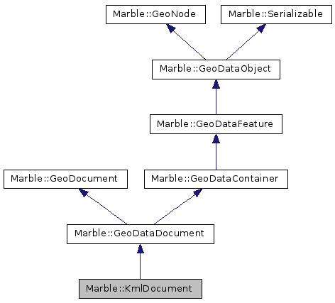
Inheritance diagram for Marble::KmlDocument:
Public Member Functions | |
| ~KmlDocument () | |
| void | setFiles (const QString &path, const QStringList &files) |
 Public Member Functions inherited from Marble::GeoDataDocument Public Member Functions inherited from Marble::GeoDataDocument | |
| GeoDataDocument () | |
| GeoDataDocument (const GeoDataDocument &other) | |
| ~GeoDataDocument () | |
| void | addStyle (const GeoDataStyle &style) |
| void | addStyleMap (const GeoDataStyleMap &map) |
| QString | baseUri () const |
| DocumentRole | documentRole () const |
| QString | fileName () const |
| virtual bool | isGeoDataDocument () const |
| GeoDataNetworkLinkControl | networkLinkControl () const |
| virtual void | pack (QDataStream &stream) const |
| QString | property () const |
| void | removeStyle (const QString &styleId) |
| void | removeStyleMap (const QString &mapId) |
| void | setBaseUri (const QString &baseUri) |
| void | setDocumentRole (DocumentRole role) |
| void | setFileName (const QString &value) |
| void | setNetworkLinkControl (const GeoDataNetworkLinkControl &networkLinkControl) |
| void | setProperty (QString property) |
| GeoDataStyle & | style (const QString &styleId) const |
| GeoDataStyleMap & | styleMap (const QString &styleId) const |
| QList< GeoDataStyleMap > | styleMaps () const |
| QList< GeoDataStyle > | styles () const |
| virtual void | unpack (QDataStream &stream) |
| Public Member Functions inherited from Marble::GeoDocument | |
| virtual | ~GeoDocument () |
| virtual bool | isGeoSceneDocument () const |
| Public Member Functions inherited from Marble::GeoDataContainer | |
| GeoDataContainer () | |
| GeoDataContainer (const GeoDataContainer &other) | |
| virtual | ~GeoDataContainer () |
| void | append (GeoDataFeature *other) |
| GeoDataFeature & | at (int pos) |
| const GeoDataFeature & | at (int pos) const |
| QVector< GeoDataFeature * > ::Iterator | begin () |
| GeoDataFeature * | child (int) |
| const GeoDataFeature * | child (int) const |
| int | childPosition (const GeoDataFeature *child) const |
| void | clear () |
| QVector< GeoDataFeature * > ::ConstIterator | constBegin () const |
| QVector< GeoDataFeature * > ::ConstIterator | constEnd () const |
| QVector< GeoDataFeature * > ::Iterator | end () |
| QVector< GeoDataFeature * > | featureList () const |
| GeoDataFeature & | first () |
| const GeoDataFeature & | first () const |
| QVector< GeoDataFolder * > | folderList () const |
| void | insert (GeoDataFeature *other, int index) |
| GeoDataFeature & | last () |
| const GeoDataFeature & | last () const |
| GeoDataLatLonAltBox | latLonAltBox () const |
| GeoDataContainerPrivate * | p () const |
| QVector< GeoDataPlacemark * > | placemarkList () const |
| void | remove (int index) |
| int | size () const |
| Public Member Functions inherited from Marble::GeoDataFeature | |
| GeoDataFeature () | |
| GeoDataFeature (const QString &name) | |
| GeoDataFeature (const GeoDataFeature &other) | |
| virtual | ~GeoDataFeature () |
| const GeoDataAbstractView * | abstractView () const |
| GeoDataAbstractView * | abstractView () |
| QString | address () const |
| QString | description () const |
| bool | descriptionIsCDATA () const |
| virtual void | detach () |
| GeoDataExtendedData & | extendedData () const |
| EnumFeatureId | featureId () const |
| bool | isGloballyVisible () const |
| bool | isVisible () const |
| QString | name () const |
| virtual const char * | nodeType () const |
| GeoDataFeature & | operator= (const GeoDataFeature &other) |
| QString | phoneNumber () const |
| qint64 | popularity () const |
| GeoDataRegion & | region () const |
| const QString | role () const |
| void | setAbstractView (GeoDataAbstractView *abstractView) |
| void | setAddress (const QString &value) |
| void | setDescription (const QString &value) |
| void | setDescriptionCDATA (bool cdata) |
| void | setExtendedData (const GeoDataExtendedData &extendedData) |
| void | setName (const QString &value) |
| void | setPhoneNumber (const QString &value) |
| void | setPopularity (qint64 popularity) |
| void | setRegion (const GeoDataRegion ®ion) |
| void | setRole (const QString &role) |
| void | setStyle (GeoDataStyle *style) |
| void | setStyleMap (const GeoDataStyleMap *map) |
| void | setStyleUrl (const QString &value) |
| void | setTimeSpan (const GeoDataTimeSpan &timeSpan) |
| void | setTimeStamp (const GeoDataTimeStamp &timeStamp) |
| void | setVisible (bool value) |
| void | setVisualCategory (GeoDataVisualCategory category) |
| void | setZoomLevel (int index) |
| const GeoDataStyle * | style () const |
| const GeoDataStyleMap * | styleMap () const |
| QString | styleUrl () const |
| GeoDataTimeSpan & | timeSpan () const |
| GeoDataTimeStamp & | timeStamp () const |
| GeoDataVisualCategory | visualCategory () const |
| int | zoomLevel () const |
| Public Member Functions inherited from Marble::GeoDataObject | |
| GeoDataObject () | |
| GeoDataObject (const GeoDataObject &) | |
| virtual | ~GeoDataObject () |
| int | id () const |
| GeoDataObject & | operator= (const GeoDataObject &) |
| virtual GeoDataObject * | parent () const |
| QString | resolvePath (const QString &relativePath) const |
| void | setId (int value) |
| virtual void | setParent (GeoDataObject *parent) |
| void | setTargetId (int value) |
| int | targetId () const |
| Public Member Functions inherited from Marble::GeoNode | |
| GeoNode () | |
| virtual | ~GeoNode () |
| Public Member Functions inherited from Marble::Serializable | |
| virtual | ~Serializable () |
Detailed Description
Definition at line 19 of file KmlDocument.h.
Constructor & Destructor Documentation
| Marble::KmlDocument::~KmlDocument | ( | ) |
Definition at line 20 of file KmlDocument.cpp.
Member Function Documentation
| void Marble::KmlDocument::setFiles | ( | const QString & | path, |
| const QStringList & | files | ||
| ) |
Temporary files to delete at destruction.
- Parameters
-
path Empty subdirectories below this directory will be deleted at destruction files List of files to delete at destruction
Definition at line 32 of file KmlDocument.cpp.
The documentation for this class was generated from the following files:
This file is part of the KDE documentation.
Documentation copyright © 1996-2014 The KDE developers.
Generated on Tue Oct 14 2014 22:38:56 by doxygen 1.8.7 written by Dimitri van Heesch, © 1997-2006
Documentation copyright © 1996-2014 The KDE developers.
Generated on Tue Oct 14 2014 22:38:56 by doxygen 1.8.7 written by Dimitri van Heesch, © 1997-2006
KDE's Doxygen guidelines are available online.