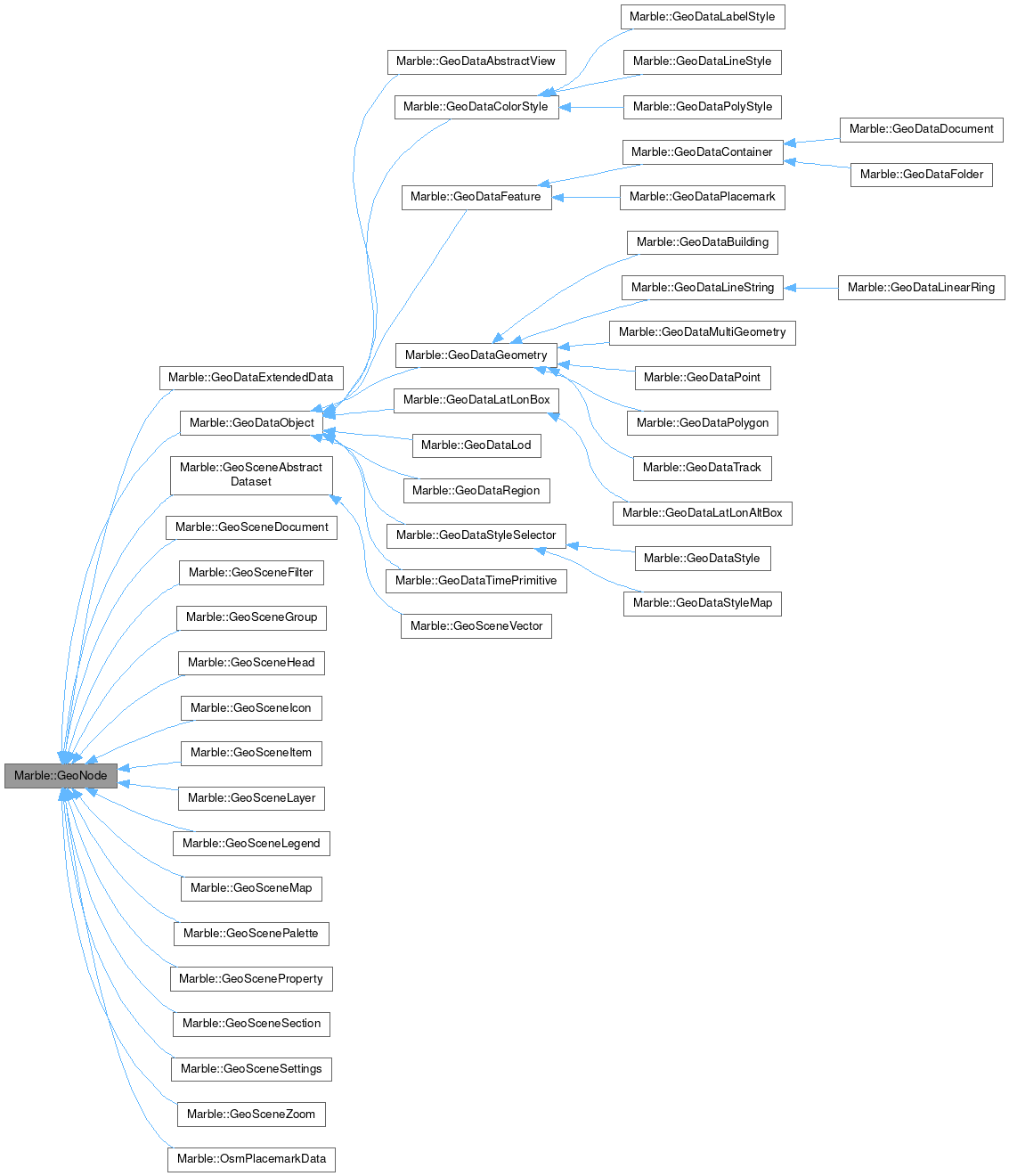
Marble::GeoNode
#include <GeoDocument.h>

Public Member Functions | |
| virtual const char * | nodeType () const =0 |
Detailed Description
A shared base class for all classes that are mapped to a specific tag (ie.
GeoFolder)
Definition at line 34 of file GeoDocument.h.
Member Function Documentation
◆ nodeType()
|
pure virtual |
Provides type information for downcasting a GeoNode.
Implemented in Marble::GeoDataBuilding, Marble::GeoDataColorStyle, Marble::GeoDataDocument, Marble::GeoDataExtendedData, Marble::GeoDataFolder, Marble::GeoDataLabelStyle, Marble::GeoDataLatLonAltBox, Marble::GeoDataLatLonBox, Marble::GeoDataLinearRing, Marble::GeoDataLineString, Marble::GeoDataLineStyle, Marble::GeoDataLod, Marble::GeoDataMultiGeometry, Marble::GeoDataPlacemark, Marble::GeoDataPoint, Marble::GeoDataPolygon, Marble::GeoDataPolyStyle, Marble::GeoDataRegion, Marble::GeoDataStyle, Marble::GeoDataStyleMap, Marble::GeoDataTimePrimitive, Marble::GeoDataTrack, Marble::GeoSceneDocument, Marble::GeoSceneFilter, Marble::GeoSceneGroup, Marble::GeoSceneHead, Marble::GeoSceneIcon, Marble::GeoSceneItem, Marble::GeoSceneLayer, Marble::GeoSceneLegend, Marble::GeoSceneMap, Marble::GeoScenePalette, Marble::GeoSceneProperty, Marble::GeoSceneSection, Marble::GeoSceneSettings, Marble::GeoSceneVector, Marble::GeoSceneZoom, and Marble::OsmPlacemarkData.
The documentation for this class was generated from the following files:
Documentation copyright © 1996-2025 The KDE developers.
Generated on Fri May 2 2025 12:01:36 by doxygen 1.13.2 written by Dimitri van Heesch, © 1997-2006
KDE's Doxygen guidelines are available online.